

Science
Our Science Principles
Actionable: meeting the urgent information needs of socio-environmental decisions
Accessible: leveraging and creating open environmental data
Collaborative: fostering interdisciplinary and community-driven problem-solving across social and biophysical sciences.
Our Science Priorities


Emphasizing approaches that can scale to global extents but using the finest resolution information available, our work centers on understanding the consequences of changes in nature and its benefits to people — where, who, and how we’re affected. Our science priorities are centered on maintaining a livable environment while equitably meeting the needs and desires of humanity, which will require a fundamental transformation of human activity on the planet.
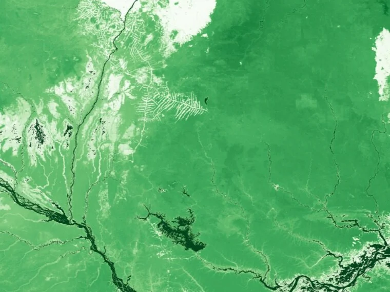
Global modeling at local scales

Nature underpins people’s well-being: bees nesting in natural areas pollinate nearby crops; plants growing along streams and on hillsides help trap pollutants, purifying our water; coastal habitats protect us from storms, erosion, and flooding. We know this and yet we’re often flying blind. In this information economy where it seems like we can find just about everything we need on Google maps, we often have no idea how and where we receive the critical but often invisible benefits nature provides, or where and when we might need them the most. Through recent technological advances, we can now map nature's benefits to people at high resolution across the whole globe. High resolutions allow us to see where people are actually experiencing those contributions and global extents reveal important patterns that can inform policies to support the linked wellbeing of people and nature. Information about our planet’s ecosystems and human activities supported by them has advanced rapidly in recent years, and continues to improve every year; satellites are providing more information more frequently at orders of magnitude finer spatial scales. Likewise, computer processing capabilities have advanced for making sense of those huge stacks of data. Leveraging cloud computing and parallel processing we can model at global extents the locally relevant processes determining how benefits from nature flow across landscapes and seascapes.
Related publication: Global modeling of nature’s contributions to people. (2019) Chaplin-Kramer et al. Science.
Advancing integration of satellite products


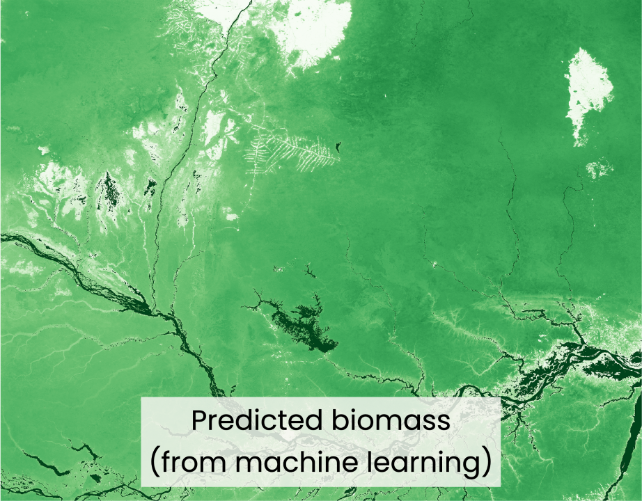

New satellite products available at increasingly fine scales and frequencies or sensing the Earth’s properties in different ways provide new opportunities for understanding how nature’s benefits are provided or experienced. Most existing models of nature’s benefits to people represent ‘nature’ as merely categorical classifications of land cover or land use, which belies the complexity of ecological processes that are driven by ecosystem characteristics represented in many satellite products. Species composition or richness, functional types or functional diversity, physical structure, productivity, phenology can provide a more continuous representation of ecosystem functions, representing the true heterogeneity in ecosystem quality or condition and impacts from different management. Some satellite products can represent nature’s benefits (or change in benefits) directly, such as water or air quality, which could be used to track changes over time or calibrate predictive models. Finally, demand-side modeling for nature’s benefits often relies largely on population as a proxy, while a suite of satellite products for mapping night-lights, impervious surfaces, settlements, infrastructure such as dams and roads, emissions and other indicators of human activity provides new ways of disaggregating beneficiaries into groups whose well-being relates to nature in different ways in order to identify populations that are more or less dependent on ecosystems and vulnerable to change.
Related publication: Spatial heterogeneity in forest carbon storage affects priorities for reforestation. Chaplin-Kramer et al. Pre-print
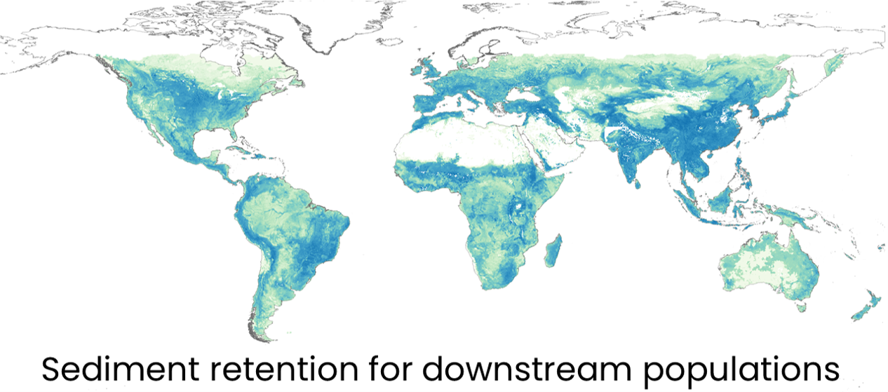
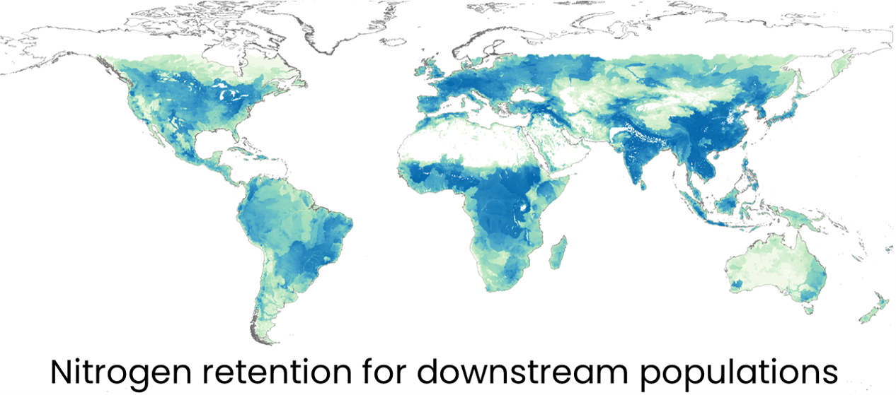
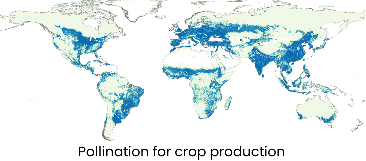
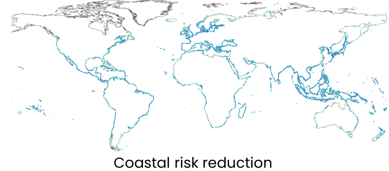
Values attribution to nature


Nature’s benefits are often mapped at their point of use, but that doesn’t always identify where the most critical benefits are provided. Whether it’s beneficiaries of clean water downstream, people within an hour’s travel of natural amenities, crops pollinated on farms, or stretches of shoreline protected, attributing those values to the habitat providing them is a key step in assessing priorities for conservation or habitat management. Our unique algorithms allow a backtracking of each benefit’s delivery process to map the value of the benefit to its source. This facilitates optimization or prioritization of multiple benefits that may be experienced or delivered to different locations but are provided by the same habitats.
Related publication: Global critical natural assets. Chaplin-Kramer et al. Pre-print.